Log in
All resources
Create a design
1,095,938 Free Images of Maps Of Carniola
david rumsey historical map collection
maps with cartouches
fonds ancely - bibliothèque municipale de toulouse - maps
maps in the library of congress
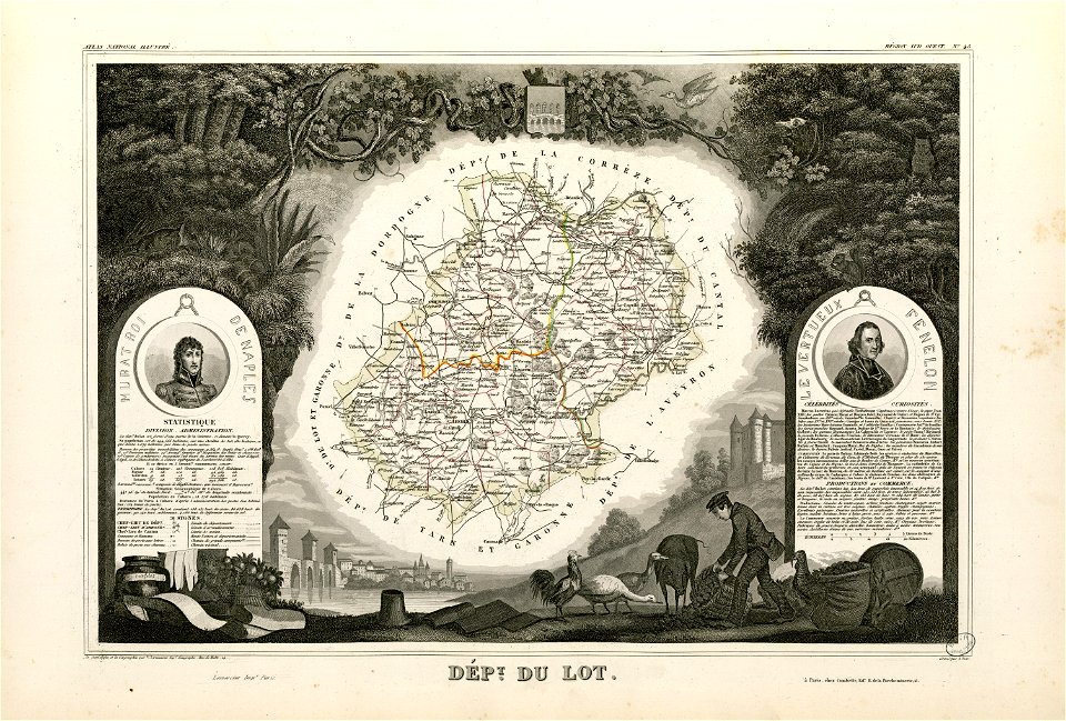
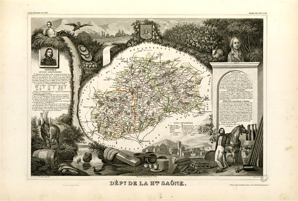
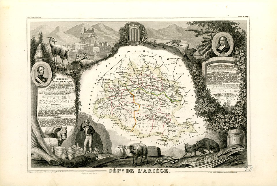
victor levasseur - maps of france
atlas van der hagen
german-language maps
1865 maps
maps in russian state archives of ancient documents
christian gottfried daniel stein
david rumsey historical map collection
maps by william faden
david rumsey historical map collection
old maps of france
copper engravings in the universitätsbibliothek salzburg
maps by abraham ortelius
johannes ratelband
jan goeree
maps in the stadsarchief amsterdam
pieter bast
david rumsey historical map collection
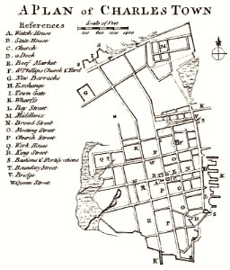
south carolina
david rumsey historical map collection
joan blaeu
donnus nicolaus germanus
latin-language maps
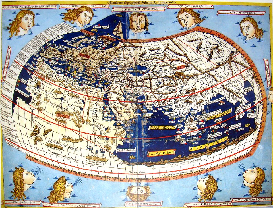
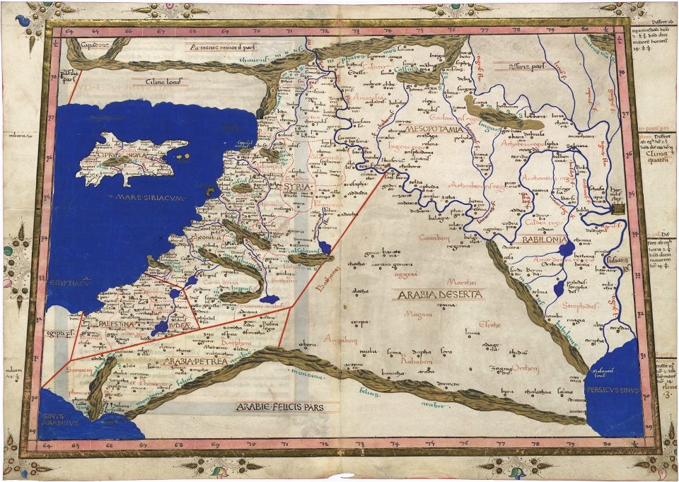
cosmographia claudii ptolomaei alexandrini
latin-language maps
david rumsey historical map collection
1813 maps
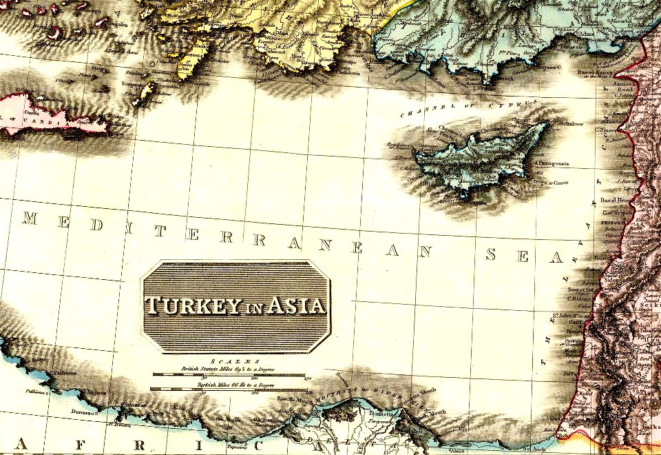
19th-century maps of the mediterranean sea
david rumsey historical map collection
david rumsey historical map collection
joan blaeu
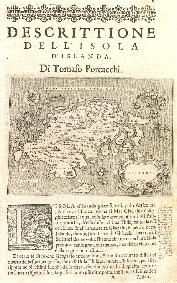
maps by coronelli
1700 maps
girolamo porro
1572 maps
david rumsey historical map collection
german-language maps
david rumsey historical map collection
german-language maps
david rumsey historical map collection
german-language maps
david rumsey historical map collection
german-language maps
old maps of mexico
covens en mortier
theodor de bry
amazon
1865 in paris
1865 maps
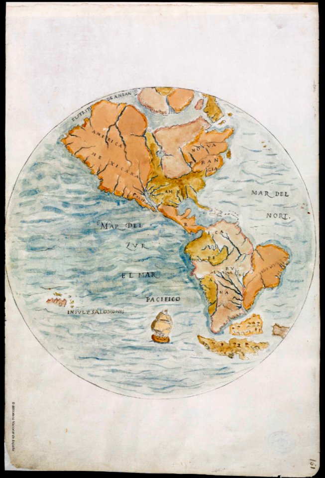
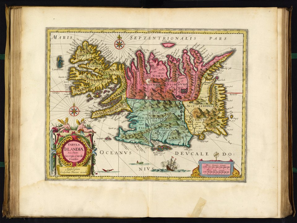
old maps of earth's hemispheres
pictorial maps
maps in the library of congress
sailing ships of spain
richard friese - mammal illustrations
syncerus caffer (illustrations)
maximilien de béthune
duc de sully
18th-century maps of indonesia
1757
fonds ancely - bibliothèque municipale de toulouse - maps
coats of arms of cities in pyrénées-atlantiques
fonds ancely - bibliothèque municipale de toulouse - maps
joachim murat
fonds ancely - bibliothèque municipale de toulouse - maps
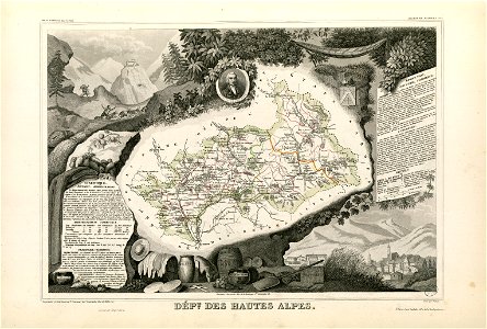
coats of arms of cities in hautes-alpes
fonds ancely - bibliothèque municipale de toulouse - maps
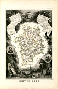
coats of arms of cities in cher
fonds ancely - bibliothèque municipale de toulouse - maps
coats of arms of vesoul
fonds ancely - bibliothèque municipale de toulouse - maps
victor levasseur - maps of france
fonds ancely - bibliothèque municipale de toulouse - maps
saint vincent de paul
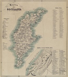
maps of gotland
pehr arvid säve
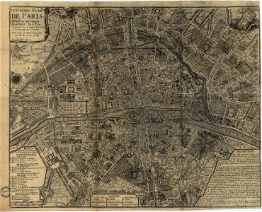
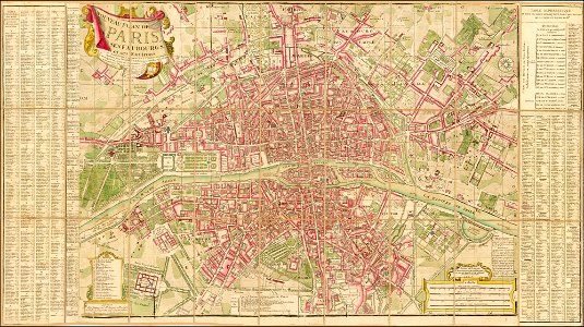
maps of paris from the library of congress
maps in the library of congress
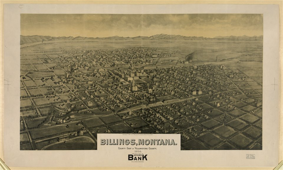
lithographs of montana
montana
maps of paris from the barry lawrence ruderman antique maps inc.
18th-century maps of paris
maps by willem and johannes blaeu
joan blaeu
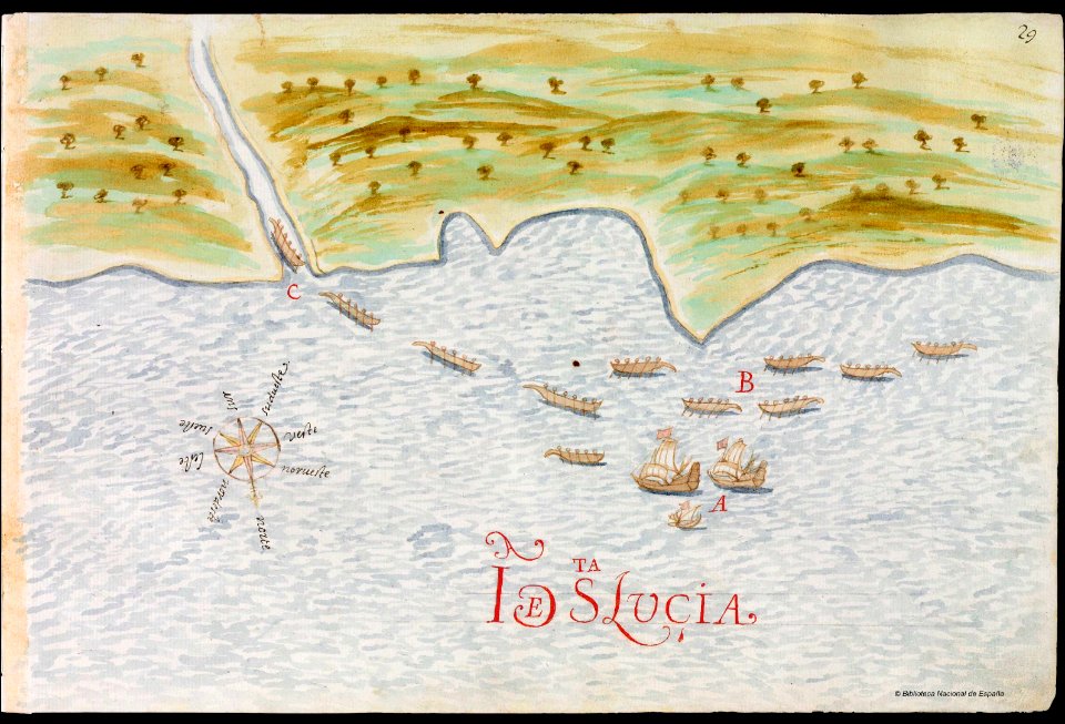
old maps of saint lucia
pictorial maps
18th-century maps of north america
1794 maps
maps by willem and johannes blaeu
lillo
maps in the library of congress
new york
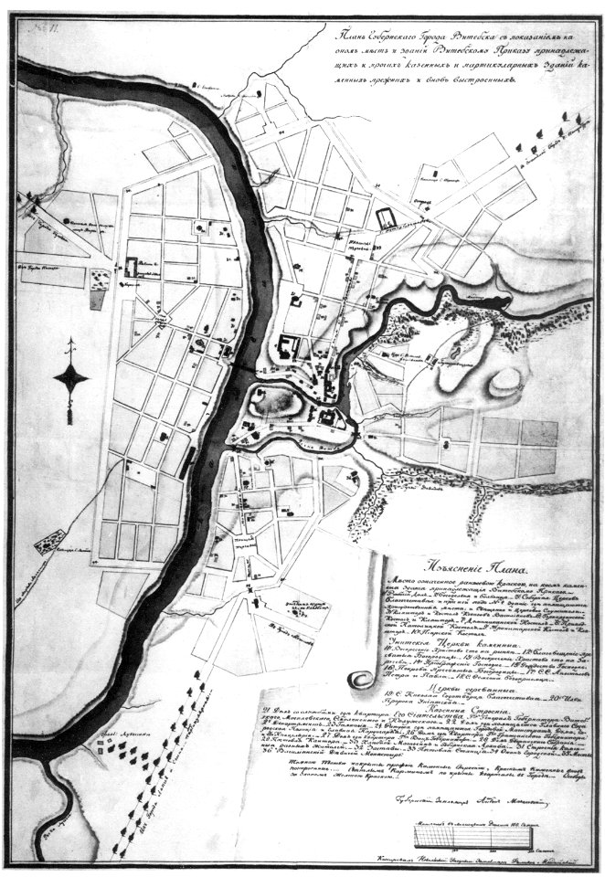
maps in russian state archives of ancient documents
historical images of viciebsk
maps in russian state archives of ancient documents
historical images of orša
maps in russian state archives of ancient documents
historical images of viciebsk
maps in russian state archives of ancient documents
historical images of viciebsk
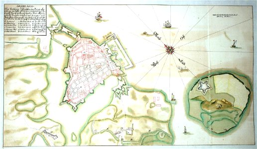
western pomerania
maps of stralsund
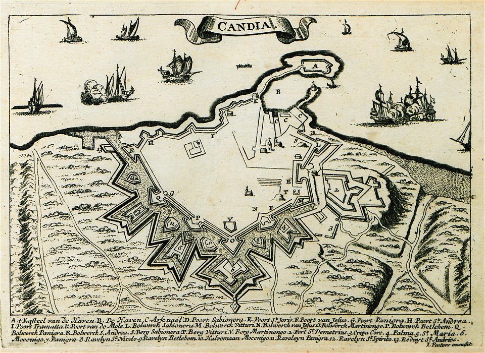
description des principales villes (1690)
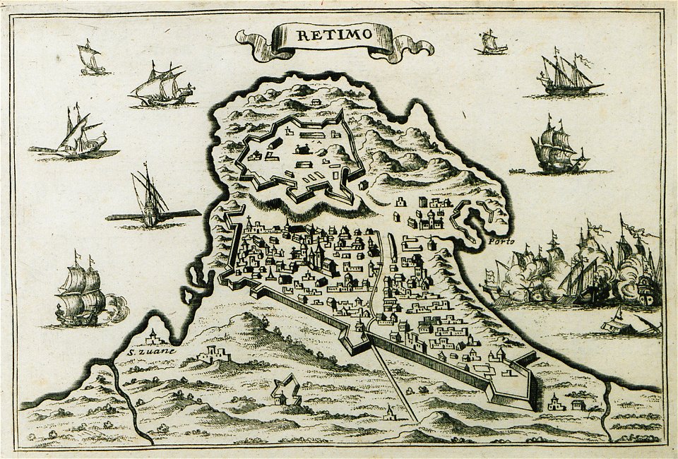
old maps of crete
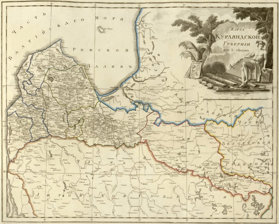
atlas of the russian empire (1800)
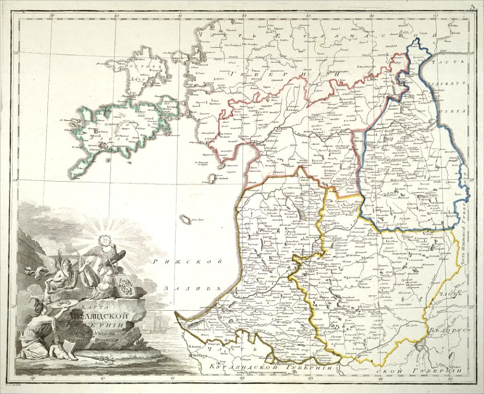
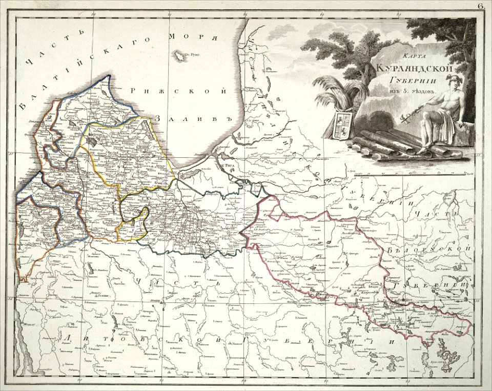
old maps of courland governorate
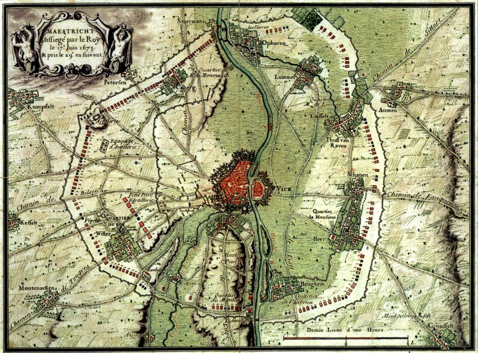
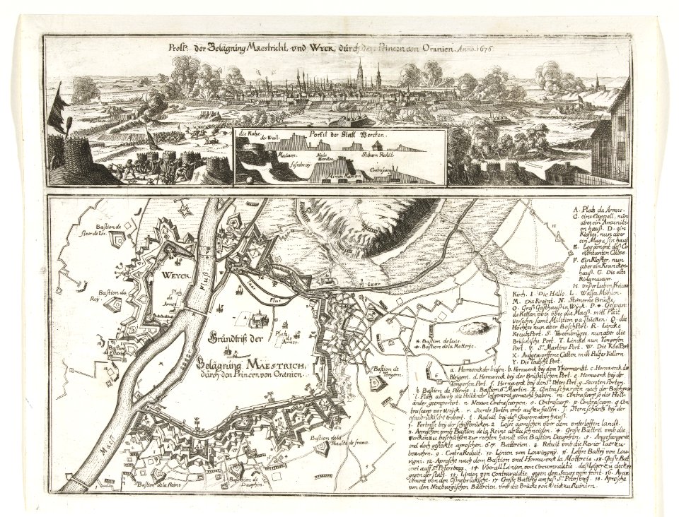
17th-century maps of maastricht
maps of the franco-dutch war
17th-century maps of maastricht
maps of the franco-dutch war
atlante veneto (raremaps.com) volume 1
maps of the bay of kotor
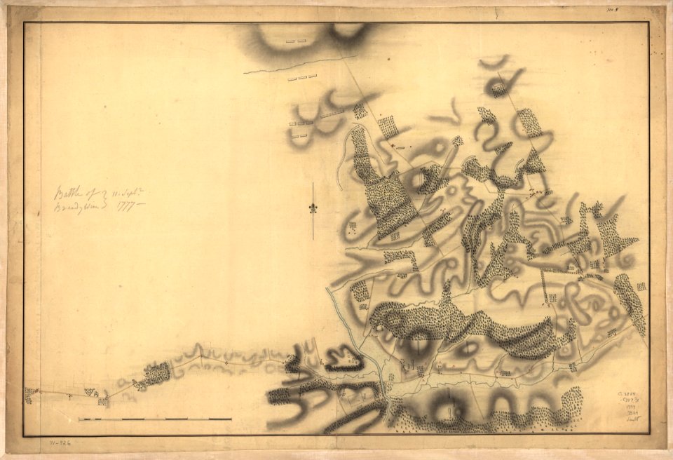
battle of brandywine
pennsylvania
battle of brandywine
pennsylvania
battle of brandywine
pennsylvania
battle of brandywine
pennsylvania
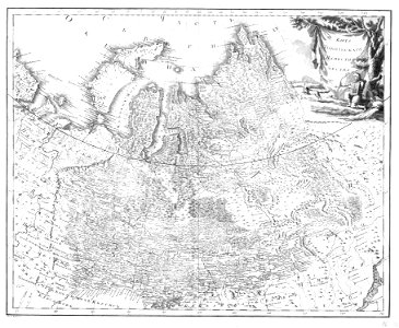
atlas of the russian empire (1792)
old maps of tobolsk governorate
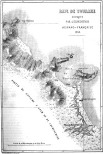
maps of french indochina
maps of da nang
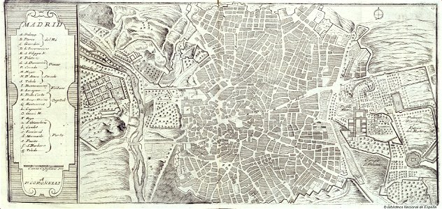
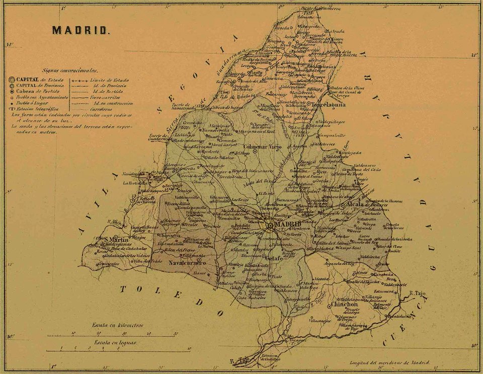
old maps of the community of madrid
1868 maps
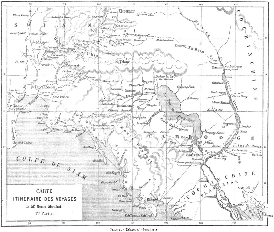
old maps of thailand
old maps of cambodia
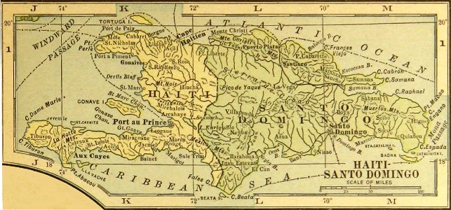
history of the dominican republic
old maps of haiti
description des principales villes (1690)
old maps of crete
atlas of the russian empire (1800)
18th-century maps of estonia
atlas of the russian empire (1800)
old maps of courland governorate
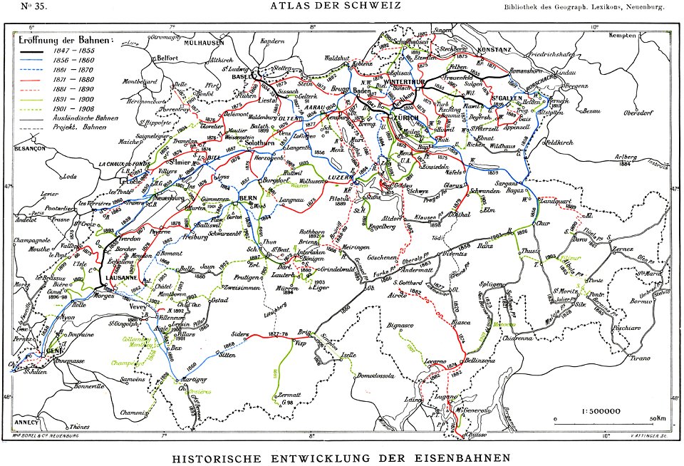
history of rail transport in switzerland
rail transport maps of switzerland
atlas of the russian empire (1792)
18th-century maps of estonia
maps in russian state archives of ancient documents
historical images of čerykaŭ
volume 3 of le tour du monde
old maps of senegal
volume 6 of le tour du monde
old maps of peru
siebmachers wappenbuch 1701/1705 - grafen
siebmachers wappenbuch 1701/1705 teil 2
18th-century maps of the spanish empire
maps made in the 18th century
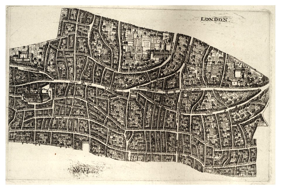
university of toronto wenceslas hollar digital collection
hollar maps and plans of london
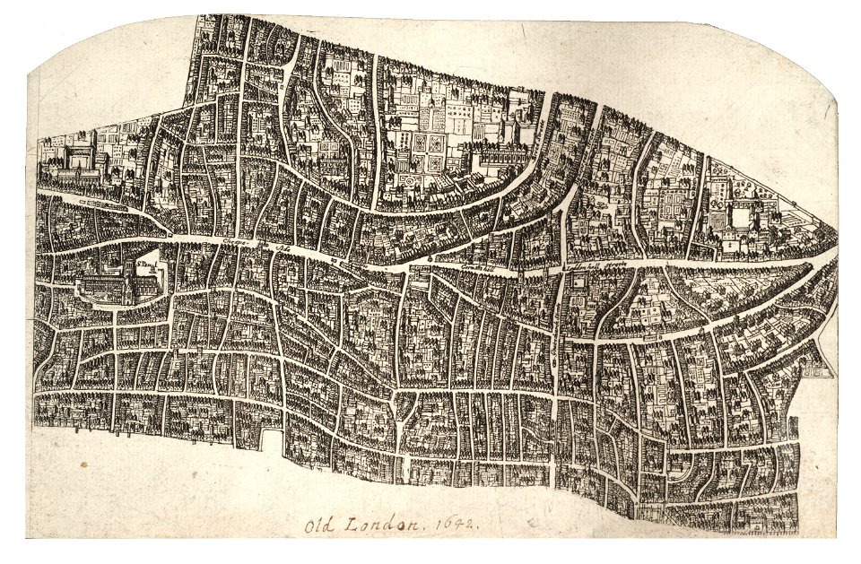
university of toronto wenceslas hollar digital collection
hollar maps and plans of london
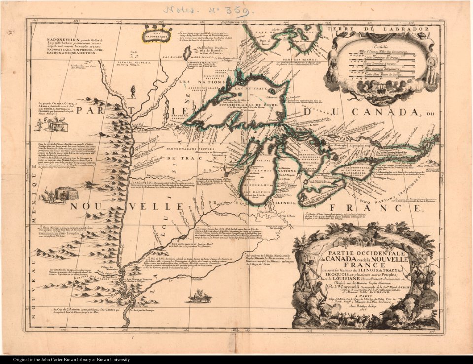
old maps of new france
maps by coronelli
maps made in the 17th century
old maps of scandinavia
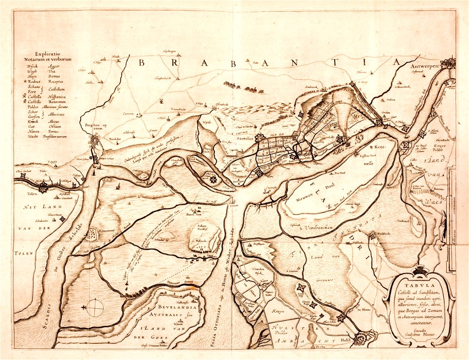
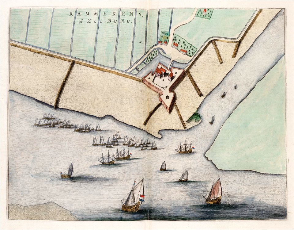
old maps of zeeland
walcheren
maps with cartouches
atlas van der hagen
maps with cartouches
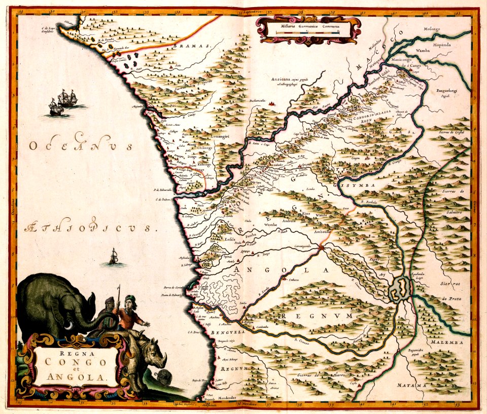
old maps of angola
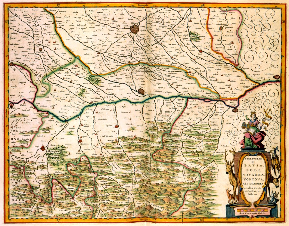
old maps of lombardy
novara
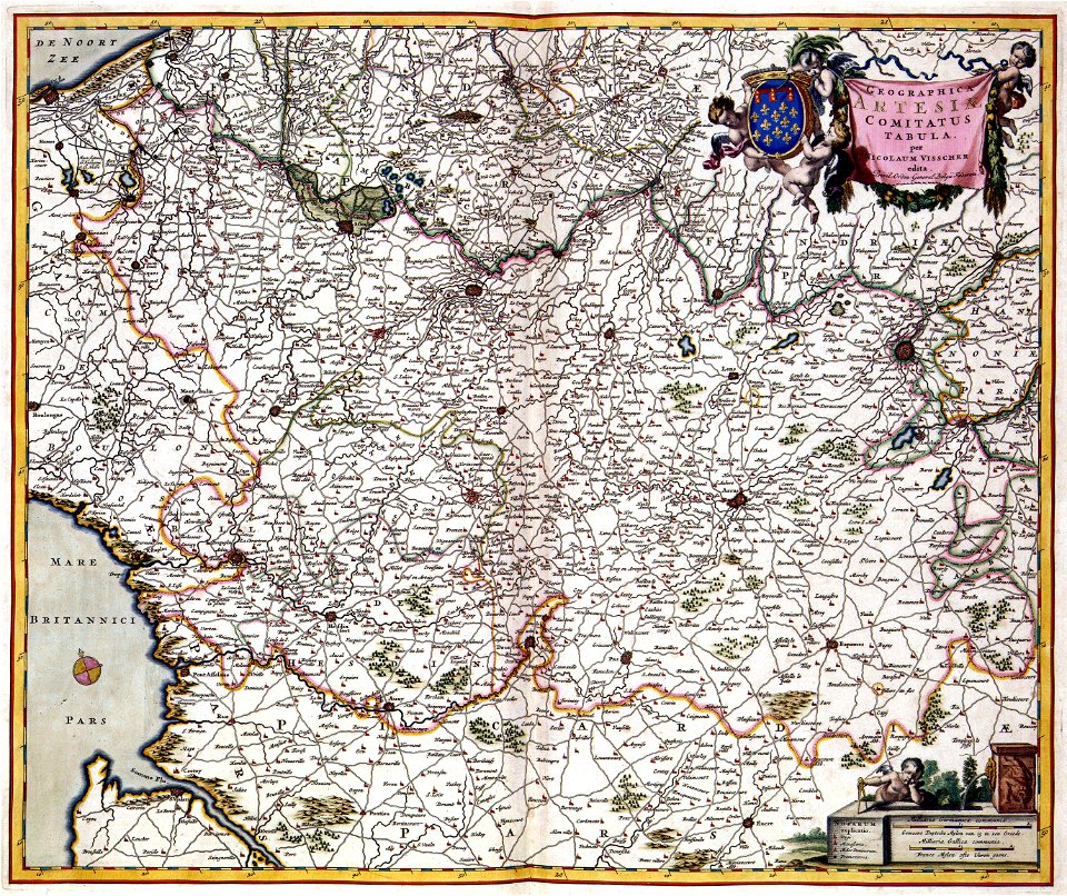
17th-century maps of france
maps with cartouches
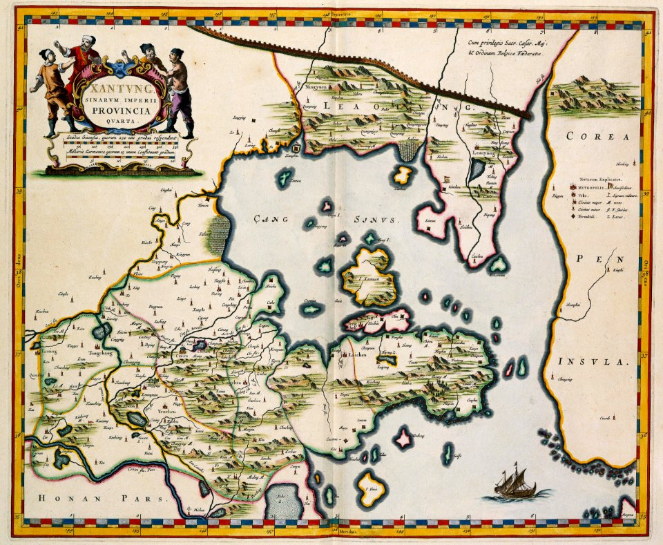
17th-century maps of china
old maps of xinjiang
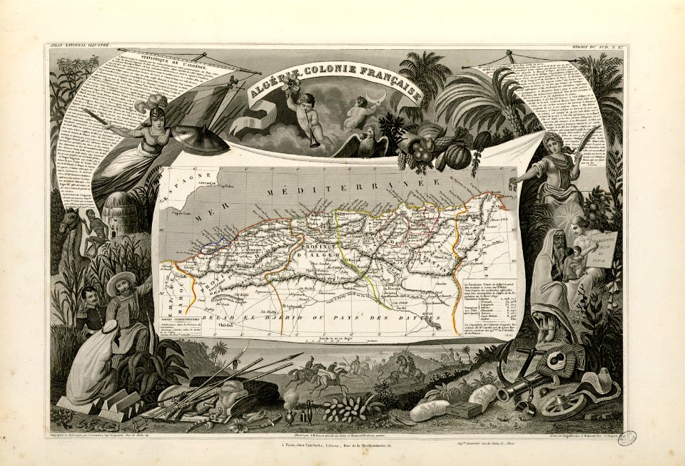
old maps of algeria
french algeria
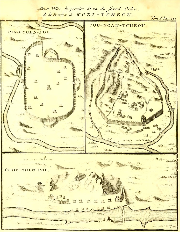
zhijin county
guizhou
maps by jacques-nicolas bellin
jacques-nicolas bellin
blank electoral vote maps of the united states
svg maps of the united states
maps by willem and johannes blaeu
old maps of zeeland
timeline of the name palestine
latin-language maps
maps made in the 17th century
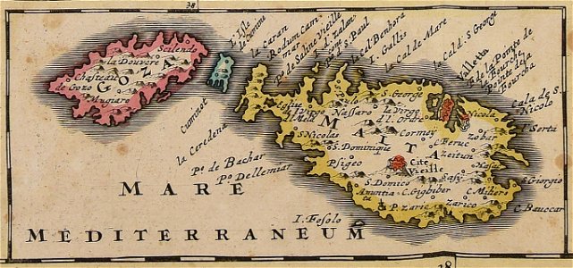
old maps of malta
victor levasseur - maps of the world
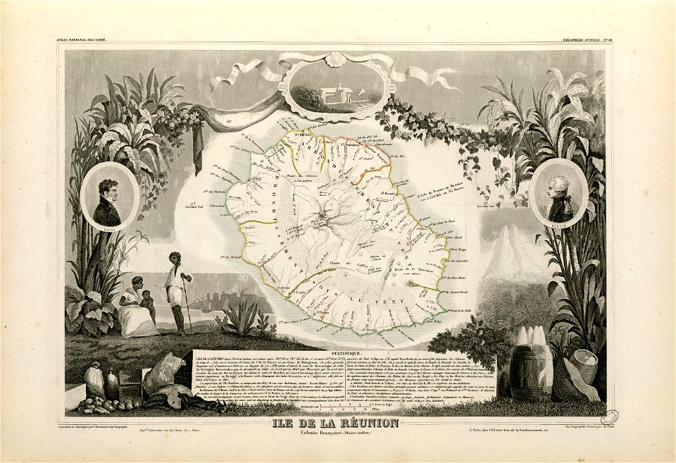
old maps of réunion
maps made in the 17th century
old maps of malta
charts and maps of the royal museums greenwich
1572 maps
old maps of new france
maps by coronelli
maps made in the 17th century
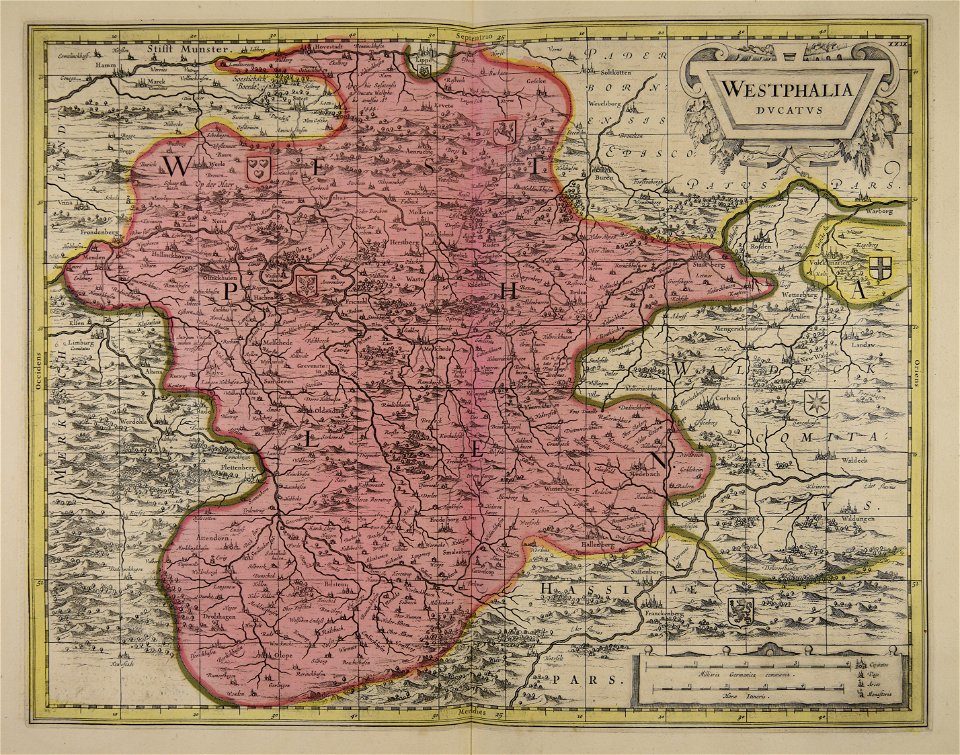
old maps of westphalia
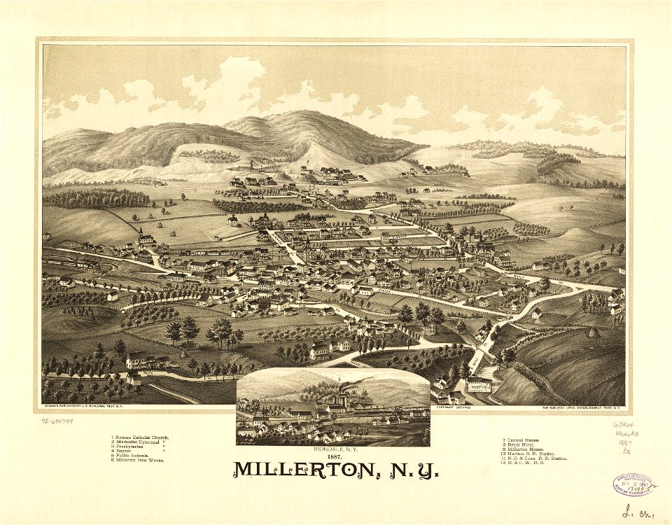
old maps of new york (state)
new york
maps with cartouches
old maps of france
atlas van der hagen (volume 4)
maps with cartouches
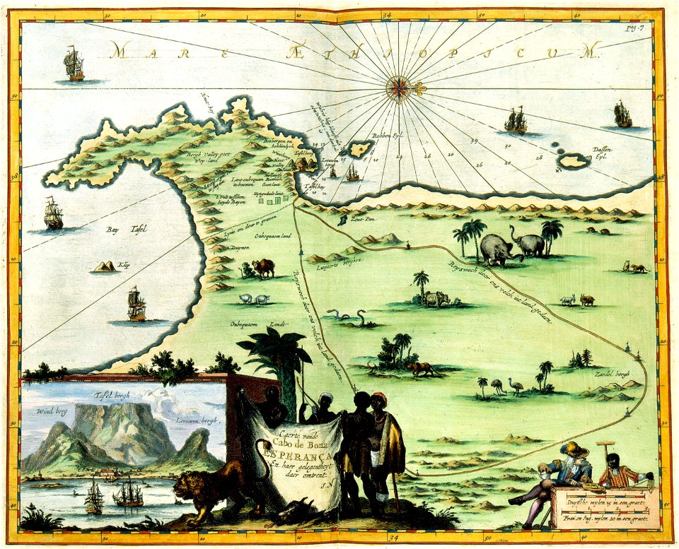
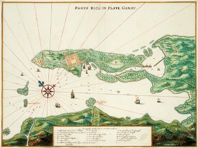
puerto rico
1665
zhangye
lanzhou
maps by jacques-nicolas bellin
jacques-nicolas bellin
atlantis magni tomus primus (biblioteca comunale di trento)
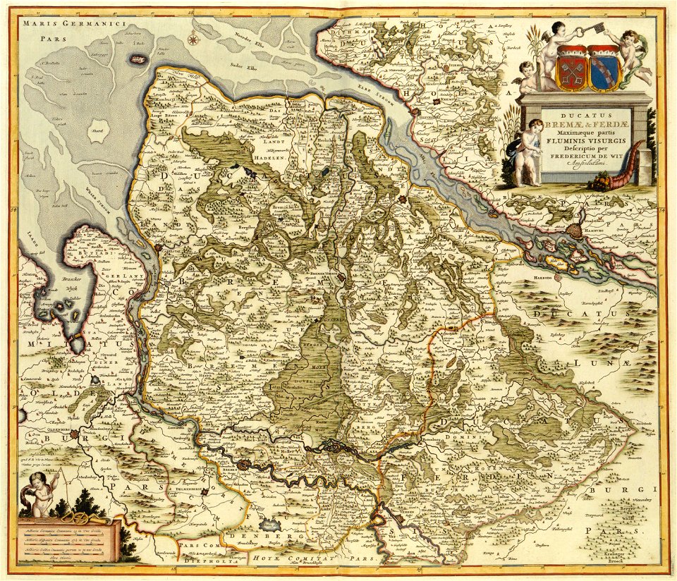
17th-century maps of schleswig-holstein
3301 - 3400 of 1,095,938
Next page
/ 10960